
The Geological Survey of South Australia (GSSA) collect, manage and deliver information and knowledge of South Australia’s geology, particularly for its mineral resources prospectivity.

About the GSSA
The work of the GSSA is critical to the continual growth of South Australia’s minerals and energy resource sector, and to our understanding of the state’s geology and resource potential.
This is achieved through five work programs:
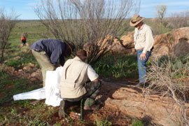
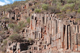
The aim of the regional geology and mapping team is continual improvement of the understanding of the geology of South Australia and its relationship to mineralisation events and prospectivity. The team is responsible for the definition, interpretation and preparation of geological data and maps for the whole of the state (>900 000 km2) and across the complete geological time scale. A key task is the field-based collection of fundamental geological data and its synthesis into maps.
Specific tasks include:
- Generating new geological data through field mapping, sampling and drilling programs and laboratory analyses
- Generating new summary geological map datasets through the combination and generalising of detailed datasets
- Generating new geological understanding by synthesis of multiple datasets and through specific geological investigations
- Defining and updating the stratigraphy and geological heritage of South Australia
- Geographic Information Systems (GIS) editing and updating of digital geological maps, and update of critical geological databases
- Providing geological advice to a range of users, particularly the mineral exploration sector, and the general public
- Publication and presentation of results at conferences
- Research and development of the best and most consistent mapping techniques for South Australia. Mappers now routinely collect field data digitally on field tablets, allowing faster and more accurate data entry of field observations into databases and rapid delivery through the South Australian Resources Information Gateway (SARIG)
- Contribution to South Australian-focused collaborative projects with other state and federal government agencies, universities and research bodies.
The mineral systems team builds on the knowledge of mineral systems across the state and assists in the development and promotion of strategies to explore for ore deposits that will deliver economic benefits to the state. The team aims to reduce exploration risk through improved methods for targeting ore deposits. This is achieved through greater understanding of the components of mineralising events, extent of the system, and the processes leading to mineral concentration and ore formation.
Specialist skills within the group include:
- Spectral data collection and interpretation related to mineral mapping at scales ranging from drill core to satellite imagery
- Dating minerals using a variety of isotopic methods
- Exploration geochemistry
- Sedimentology and diagenetic processes in mineral concentration
- 3D modelling of mineral systems
Active collaborations with research groups, both locally and internationally, ensure that exploration models for key commodities are continually updated, and provide opportunities for testing and promotion of new ideas.
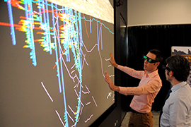
The geophysics and prospectivity team's functions include the acquisition, maintenance, interpretation, modelling and delivery of geophysical and remotely sensed data to state, national and global stakeholders as well as the integration of geoscientific data into GIS, 3D models and predictive modelling frameworks to support exploration, land use and planning.
The responsibilities of the team include:
- Quality assurance and quality control (QA/QC) of company submitted geophysical data as part of legislative exploration reporting requirements
- Delivery of precompetitive geophysical data and products
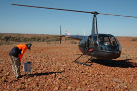
- Design of regional scale geophysical surveys
- Custodianship of mineral geophysical and petrophysical information for South Australia
- Undertaking geophysical surveys to promote investment in South Australia
- Creation and dissemination of 3D geological models
- Development and delivery of geoscientific data and information as GIS products.
The role of the team is to assess, document and ensure the sustainable development of the State’s mineral resources for the benefit of the community by providing:
Resource assessment, advice and reviews of metallic minerals, construction materials, dimension stone, industrial minerals and gemstones on both the deposit and regional scale.
- Mineral resource information and advice to assist government agencies and local councils on land use planning matters and decision making and provide mineral resource potential maps that identify strategic resources near population centres
- An up to date mineral deposit database (MINDEP) of the state’s mineral occurrences, mines and prospects detailing commodity, geology, history, mineralogy, production and resources
- Tenement evaluation of mining lease proposals and exploration release area (ERA) applications to ensure responsible development and exploration of the state’s mineral resources.
The geoscientific information management (GIM) program’s core business is to manage and develop Mineral Resources Division (MRD) data and information systems in order to promote South Australia's prospectivity in the global market place. This involves assembling, maintaining and making available geoscientific information to meet the expectations of all customers and stakeholders.
GIM is responsible for:
- delivering high quality, precompetitive data and information which is built to meet the diverse needs of customers and stakeholders
- contributing to an enhanced understanding of the state's geological framework and mineral resources potential and improving perception of its prospectivity
- providing advice to companies on meeting their obligations regarding statutory data submission
- ensuring MRD's information products reflect emerging technologies
- providing consultancy and advice to support the development of data management capabilities for internal customers
- providing custodianship of mining-related data and databases
- providing geoscientific data and expertise to industry and academic research projects
- monitoring earthquake risks to the community by maintaining a network of seismic recording equipment
- maintaining a range of relevant geoscientific collections on behalf of the state, including a physical repository for geological samples/specimens
- providing laboratory and logistical support to MRD staff.