Making spatial metadata discoverable.
Contemporary computer data mining techniques – such as deep learning and machine learning – require data to be discoverable and to support machine-to-machine interactions between systems. To achieve interoperability, metadata standards are crucial and open standard formats are becoming world’s best practice.

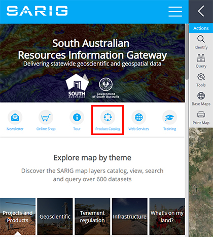
SARIG landing page highlighting the quick link to the Product Catalogue.
The Department for Energy and Mining is custodian to an extensive library of spatial data and associated maps and publications which are publicly available via the South Australian Resources Information Gateway (SARIG). Since 2014 SARIG has offered users a suite of geoscientific and tenement regulation web services including Web Mapping Service (WMS) and Web Feature Service (WFS) using Open Geospatial Consortium (OGC) geospatial international open standards.
Adding to these services, the department has recently developed a new open data spatial metadata Catalogue Service for the Web (CSW). CSW is an OGC open standard allowing users to discover and query metadata, including associated resources such as maps, publications or data downloads by the CSW endpoint using Python programming language (pycsw). pycsw is certified OGC compliant and is an OGC reference implementation.
The development of the new catalogue included the transfer of the spatial metadata into the International Organization for Standardization (ISO) ISO 19115 format. ISO 19115 has been approved for use by Standards Australia and Standards New Zealand and is recommended for better sharing of digital information resources.
Users can view the new spatial metadata catalogue online (Product catalogue - SARIG) or use the quick link located on the SARIG landing page.
View the GetCapabilities document (an XML file that provides metadata for the service)
– Christie Gerrard, June 2019


