New and improved baseline geoscience of the Delamerian Orogen.
A review and compilation of existing geoscience data across the Delamerian basement to the Murray Basin has been released as part of the Geological Survey of South Australia (GSSA) collaboration with the MinEx CRC National Drilling Initiative.
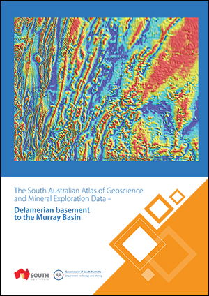
The South Australian Atlas of Geoscience and Mineral Exploration Data – Delamerian basement to the Murray Basin provides a pictorial snapshot of existing data. Land access, current and previous exploration, mineral deposits and occurrences, surface and basement geology, drillhole and rock sample geochemistry, HyLogger data, constraints on depth to crystalline basement, potential field geophysics and magnetotellurics are included.
The year-long investigation has informed area selection for drilling activities to take place in 2021. The two regions chosen for further focused research – including the collection of additional samples of the basement through drilling – have been picked for their potential to improve our interpreted basement geology understanding, and have the biggest impact on mineral prospectivity.
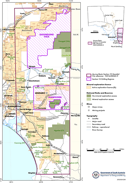
The regions – Quondong Vale in the northern Murray Basin, and Alawoona in the central part – are retained under Section 15 gazettal for the duration of the drilling program (Fig 1). The remainder of the broader Section 15, which was in place during the review, has been released and is open for exploration licence applications.
Figure 1 Delamerian National Drilling Initiative drilling regions.
Data release
Complementing the atlas are an interpreted basement geology map, drillhole logs , reprocessed geophysical imagery, depth to basement constraints, and an electrical resistivity model from AusLAMP. The model can be visualised on SARIG from surficial depths to 400 km (noting that ~10–200 km are the most reliable depths). It was produced using long-period AusLAMP magnetotelluric data on a 0.5 degree array across eastern South Australia, New South Wales and Victoria. The project was a collaboration between the GSSA and Geoscience Australia, providing important orogen-wide context to the Delamerian in South Australia.
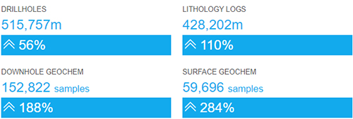
A significant proportion of legacy data that was not previously in the GSSA database has been uploaded and is now available via the South Australian Resources Information Gateway (SARIG).
Infographic on new data added.
These datasets represent updates and improvements to key baseline geoscience datasets for the historically under-explored region and reduce exploration risk in diving under cover east of the Mount Lofty Ranges.
- More information on the Department for Energy and Mining website
- Technical update on the Phase 1 data release
- See MESA Journal News 2019:30–33 for program start up.
– Tom Wise and Stacey Curtis, October 2020


