Groundwater analyses are helping the search for new mineral prospective areas.
Mineral signatures of groundwater are one step closer to being traced back to the source, thanks to a collaboration between CSIRO, Geoscience Australia and the Geological Survey of South Australia. Extensive fieldwork and numerous analyses have proven that it is possible to test for and detect mineral signatures from ore deposits in groundwater – and the hunt is now on for similar signatures in other areas that are not near known mines.
The Hydrogeochemical Atlas for South Australia, available on the South Australia Resource Information Gateway (SARIG), is part of a national initiative that builds on previous work to make interpretations based on the statewide geology. It aims to examine regional trends in groundwater chemistry, determine links to underlying lithology and aquifer sources and, if possible, present new potential areas of interest for mineral exploration. All datasets included in the atlas have been through extensive quality assessment and quality control checking (Fig. 1).
Figure 1 Groundwater sample sites in South Australia shown over 1:2 million scale solid geology.
Trace element and precious metal concentrations have much less data available but where they are available we have a direct link to mineralisation and mineral systems. Elements such as gold do not often occur in detectable concentrations outside of mineral systems, so where they do occur they are of great interest (Fig. 2). The hydrogeochemical atlas is just as valuable for land use, groundwater resource modelling and water quality advice – eg high levels of lead or arsenic in groundwater that can be harmful to human, animal and plant health.
Figure 2 Gold concentrations across South Australia.
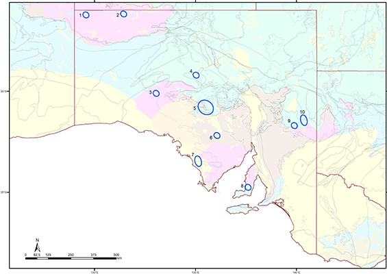
Individual elements and parameters have been shown to highlight major lithological boundaries as well as major aquifer systems. This provides baselines for environmental and mineral exploration studies in these regions. At a smaller scale, some but not all of the major mine camps can be seen in some parameters depending on the mineralisation style and host rocks, and the amount of hydrogeochemical data available for each site. Some new areas for potential mineralisation have been identified based on the known mineralisation expressions (Fig. 3). This regional data demonstrates the value of using hydrogeochemistry for regional lithology mapping and geological interpretations under cover.
Figure 3 New areas of potential mineralisation based on the available hydrogeochemical data.
Major parameters such as total dissolved solids and acidity have the largest spread of data across the state, so it is important to gain as much information from these parameters as possible. These parameters are also scale dependant – eg at the regional scale the sulfate to chloride ratio relative to sea water can show major aquifer system changes and differences between underlying crystalline basement and sediments, but at closer scale can be used to indicate the weathering of sulfides.
The atlas was released in late 2019 and coincides with the collation of all of Australia’s geochemical datasets into the Australian Groundwater Explorer, a centralised water data portal by the Bureau of Meteorology.
- Access the Hydrogeochemical Atlas for South Australia. Search for ‘Hydrogeochemical Atlas - sample site indicator’.
Data layers for acidity and total dissolved solids are available by searching for ‘Hydrogeochemical Atlas’ in the All Map Layers section of SARIG.
– Anna Petts, April 2020
This article is summarised from a GSSA Discovery Day 2019 poster (PDF 1.9 MB) by Nathan Reid, David J Gray, Tania Wilson, Anthony Reid, Patrice de Caritat, Anna Petts and Rob Thorne.


