
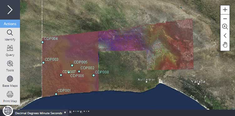
The Coompana Drilling Project targeted a number of different geological domains based on their distinct geophysical characteristics, to sample as broad a range of basement lithologies as possible. Drilling commenced in early April 2017 with the drilling of the first hole CDP001 and was completed in mid-September 2017. Eight holes were drilled for a total of 4,565 m including more than 1,871 m of diamond core. All holes were drilled at a slight inclination of either –80° or –85° towards 000° (with the exception of CDP007 which was drilled towards 270°), with the core being orientated for structural analysis. The drilling recovered a range of distinct lithologies from the different geophysical domains including migmatitic orthogneisses, felsic intrusions, mafic intrusions and volcanics.
On completion of the drilling program, all core and cutting samples were relocated to the South Australia Drill Core Reference Library. Non-destructive chemical and mineralogical data has been acquired on the core using the HyLoggerTM and MinalyzeTM systems housed at the Core Library. More than 200 physical samples of the different lithologies have been assayed for full suite lithogeochemical data. A total of 35 samples have been submitted for samarium–neodymium isotopic analysis at the University of Adelaide to help constrain the crustal evolution of the province. Twelve samples have been processed for zircon geochronology using the SHRIMP IIe instrument at Geoscience Australia and hafnium isotopic analysis at Curtin University.
The final results of the Far West Discovery Program were presented at a free workshop hosted at the South Australian Drill Core Library on the 1st of August 2018.
Latest results
Pre-drilling geophysics
Prior to the commencement of drilling, a number of geophysical techniques were trialled to ascertain their effectiveness at determining the thickness and nature of the cover units. This was an important step in the drill planning workflow as it allowed better planning of the proposed drillholes.
Two reports present the results of depth to magnetic basement modelling, undertaken in collaboration with CSIRO using the new Coompana Magnetic and Radiometric survey data.
- Magnetic depth to basement mapping over the Coompana area
- Source magnetisation studies of the reverse magnetic anomalies in the Coompana area
Preliminary field-data reports for drillholes CDP001–007
This report series provides the first release of the preliminary data collected on-site during the drilling of each Coompana Drilling Project drillhole, CDP001 - CDP007. Each compilation includes well completion information, location and site access data, results of pre-drilling cover geophysics and depth estimates as well as the field geological logs and acquired down-hole geophysical data.
The report series is available for download from SARIG
Coompana drilling and geochemistry workshop
The final results of the Far West Discovery Program were presented at a free workshop hosted at the South Australian Drill Core Library on the 1st of August 2018.
Interpreted geology of the eastern Coompana Province
West of the Gawler Craton, the Coompana Province is entirely unexposed, with cover ranging from a few hundred metres to greater than 1400 m beneath the Denman and Officer basins. Prior to the Coompana Drilling Project, minimal crystalline basement intersecting drillholes were available to constrain largely geophysical interpretations of the Coompana Province basement geology. Wise et al. provided a preliminary interpretation of broad geophysical domains in the South Australian portion of the Coompana Province based on the 2015 Coompana airborne survey, which has been updated and refined with new insights from data acquisition campaigns.
This 1:500,000 scale map represents a constrained (where possible) interpretation of the geological units, features and structures within the eastern Coompana Province and incorporates the newly-defined stratigraphic units intersected in the Coompana Drilling Project.
Download the Interpreted geology of the eastern Coompana Province, 1:500 000 scale digital map
Coompana data in SARIG
View Coompana data via South Australian Resources Information Gateway (SARIG)
Related links