Wolfgang Preiss
Visiting Honorary Research Fellow, University of Adelaide, and Geological Survey of South Australia, Department for Energy and Mining
Download this article as a PDF (31.8 MB); cite as MESA Journal 91, pages 33–50
Published December 2019
Contents
Introduction
Producing a new geological map
Stratigraphy
Structure and tectonics
Geological history
References
Introduction
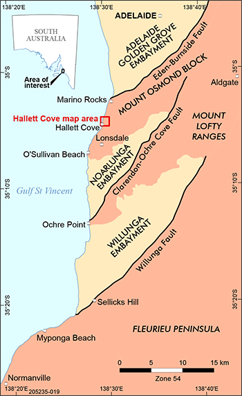
Figure 1 Locality map showing Hallett Cove geological map area and embayments of the Cenozoic St Vincent Basin.
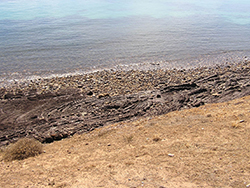
Hallett Cove (Fig. 1) is one of South Australia’s foremost natural science treasures. Concepts of superposition of strata, unconformities (representing time breaks), and folding and faulting of sedimentary rocks are clearly displayed. Professor Ralph Tate discovered evidence of ancient glaciation in the form of polished and striated rock surfaces on the clifftops (Tate 1877) and the site has attracted scientific attention ever since. The area has seen at least three separate glaciations in its long history, and displays evidence of a cold, dry, windy climate during a fourth. Recognition of past climatic variations provides a historical context for understanding current climate change.
Besides its geoscientific features, Hallett Cove is an important anthropological and botanical site. Aboriginal artefacts, including hammer stones, flaked cutters and scrapers, were discovered in sandy sediments overlying calcrete at Hallett Cove by Harold Cooper, and shown to anthropologist Norman Tindale in 1934 (Cooper, Kenny and Scrymgour 1972). The steep and inaccessible slopes between the plateau and the cliffs have ensured the survival of native scrub, and the coastal dunes are vegetated with plants typical of this environment, including daisies, ruby saltbush, pigface, sedge and spinifex. Cooper, Kenny and Scrymgour (1972) described 20 plant species from Hallett Cove, illustrating them with sketches, and also outlined some of the early history of European settlement.
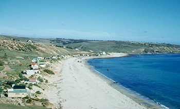
Figure 2 Former beach shacks in 1955 before proclamation of Hallett Cove Conservation Park. (Photo 045028)
The proximity to Adelaide, the diversity of rock types and field relationships, the evidence of past glaciations, and the remnant native flora and fauna have made Hallett Cove a highly valued conservation park with wide application in public education. Many generations of school and university students in disciplines as diverse as geography, history, geology, paleontology, botany, zoology, archeology and environmental science have enjoyed informative excursions to this site. For many geology students, Hallett Cove was their first introduction to field geology, where detailed structures produced by sedimentary, glacial, tectonic and erosional processes can be observed and studied. Before Hallett Cove became incorporated into the Adelaide Metropolitan area in the 1970s, Hallett Cove beach was fringed with shacks used for recreation and fishing (Fig. 2).
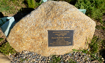
Figure 3 Plaque on granite erratic next to walking trail, dedicated to Jean Minards and Maud McBriar in recognition of their campaign to preserve Hallett Cove. (Photo 417972)
A narrow clifftop strip north of the cove, generously gifted by the estate of George Sandison, was established as the Sandison Reserve by the National Trust in 1960 to preserve the exposed glacial pavements, with protection legislated in 1965. However, this left the remainder of the glacial sediments as well as the erosional landform known as 'The Amphitheatre' unprotected. With the southward spread of suburbia during the 1960s, pressure to develop the Hallett Cove area for housing was inevitable. A proposal in 1971 to subdivide the whole of the area of the present conservation park and to construct a boat harbour in the cove would have involved major earthworks resulting in destruction of most or all of the geoscientific features. As the University of Adelaide Geology Department had been using Hallett Cove to introduce first-year geology students to field geology for many years, the university’s Senior Demonstrator Maud McBriar became extremely concerned, and started a long and tireless campaign to preserve this precious resource. An expanded area adjacent to the Sandison Reserve was declared one of the state’s first Geological Monuments by the Geological Society of Australia, but protection was not assured until the proclamation of the Hallett Cove Conservation Park by the South Australian government in 1976 (Fig. 3). The shacks were removed, walking trails and boardwalks were created, and a management plan for the park was released (Toteff 1983; National Parks and Wildlife Service 1986).
Despite publication of at least five field guides to Hallett Cove (Talbot and Nesbitt 1968; Cooper, Kenny and Scrymgour 1972; Giesecke, Whatmough and Major 1999; Mines and Energy South Australia 1996; Willoughby 2010) and the erection of explanatory signs at sites of geoscientific significance by the Department of Mines and Energy throughout the park in the 1980s, no modern detailed geological map using current stratigraphic nomenclature has been published. Geological studies before the mid-20th century include Howchin (1895, 1924, 1928), Segnit (1940) and Sprigg (1942). Segnit’s map presented the first detailed coverage of the geology of Hallett Cove, but his interpretations were questionable even at the time the map was published, including his inferred age range from Middle Precambrian to Cambrian for the Neoproterozoic bedrock stratigraphy. Of interest was his interpretation of what is today known as the Reynella Siltstone Member (representative of the Marinoan Elatina glaciation in the Adelaide area) as an in-faulted block of Sturt Tillite, suggesting that he recognised the glacial affinity, though not the age, of this important unit. The glaciated pavements and poorly lithified glacial sediments of Hallett Cove, already identified as probably of Permian age by Howchin (1895, 1924), were considered Cretaceous by Segnit. Although this view has not been shared by other investigators, definitive evidence of Cretaceous glaciation elsewhere in South Australia has more recently been confirmed (Alley and Frakes 2003). Segnit’s account of the Cenozoic sediments of Hallett Cove was less controversial.
Sprigg’s (1942) account of part of the western Mount Lofty Ranges included a geological map of Hallett Cove displaying considerably more detail in the bedrock, the late Paleozoic glacials and the Cenozoic sediments. Surprisingly, Sprigg’s map has not been reproduced in any of the later field guides and papers. A much generalised version of the map was incorporated into the Echunga 1:63,360 map (Sprigg and Wilson 1954) and forms the basis for the 1:100,000 digital geology available through the South Australian Resources Information Gateway (SARIG).
Significant later geoscientific research included studies of the stratigraphy and sedimentology of the Neoproterozoic bedrock (Thomson 1966; Alexander 1984; Dyson 1992; Dyson and von der Borch 1986), the late Paleozoic glaciation (Harris 1971; Bourman and Alley 1990; Normington et al. 2018), Pliocene stratigraphy and paleontology (Ludbrook 1963) and Quaternary geology (Firman 1966; Ward 1966; Sheard and Bowman 1998; Sheard et al. 2016). Of these, only Alexander (1984) included a geological map, which focused on the Neoproterozoic and remains unpublished. The Department for Energy and Mining has recently produced a Discovery Trail for Hallett Cove, which can be accessed through SARIG.
Producing a new geological map
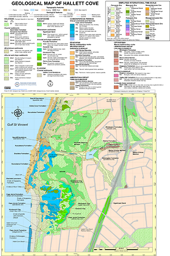
Following frequent inquiries about maps of Hallett Cove, the author drew upon personal observations gathered over many years to construct a new geological map of the conservation park (Preiss 2019a). The ready availability of fully rectified colour aerial imagery enabled photo-interpretation of lithological boundaries, and their interpolation between control points located by global positioning system (GPS). Cartography was carried out simultaneously with photo-interpretation, on screen, using geographic information system (GIS) software. Symbols and colours for geological units were selected to approximate widely used colour schemes and lithological overprints.
The map consists of a series of superimposed layers, each representing a separate geological unit and topographic features, and is presented as a layered PDF. These units are combined into folders of age-related layers within the PDF. Folders, as well as individual units, can be switched on or off. With all layers on, the map represents all geological units exposed at the surface, including soil cover, topographic features and grid-lines. By switching successive underlying layers (or folders) off, the various strata can be progressively stripped until the interpreted bedrock geology is laid bare.
Figure 4 is a reduced version of the map, but the full-sized layered map PDF can be downloaded via SARIG. Use of a PDF reader is recommended.
Stratigraphy
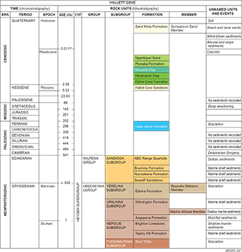
Figure 5 Summary of the chronostratigraphy and lithostratigraphy of the rocks and sediments exposed at Hallett Cove. For more detail see the accompanying geological map (figure 4).
The geology of Hallett Cove includes sediments and sedimentary rocks deposited during four discrete geological episodes: Neoproterozoic, Carboniferous–Permian, Pliocene and Quaternary. The deposits of these ages are described below. Figure 5 summarises the stratigraphy of the rocks and sediments of Hallett Cove.
Neoproterozoic Era
The ancient bedrock of Hallett Cove is part of the Neoproterozoic Adelaidean System found throughout the Mount Lofty and Flinders ranges. These sedimentary rocks were deposited between c. 830 and 510 million years before present (Ma) in a complex of rift and sag basins known traditionally as the Adelaide Geosyncline (Sprigg 1952). In the Mount Lofty Ranges, the generally westward-younging succession of the Adelaidean System between Aldgate and Ochre Point (Fig. 1) was first formalised and subdivided into the Torrensian, Sturtian and Marinoan series by Mawson and Sprigg (1950). The Sturtian Series includes the Sturt Tillite, recording the oldest of South Australia’s glaciations (Preiss et al. 2011). This distinctive rock occurs at Hallett Cove only as erratics in the Carboniferous–Permian glacial deposits of the Cape Jervis Formation. The Marinoan Series is characterised by red-coloured sedimentary rocks and limited evidence of the Elatina glaciation (Williams et al. 2011). The Sturt and Elatina glaciations occurred in the Cryogenian Period of the Neoproterozoic Era, but most of the strata exposed in the coastal cliffs at Hallett Cove were deposited during the latest Neoproterozoic, in the Ediacaran Period, so named after the metazoan fossil assemblage found in the Ediacara Hills by Reg Sprigg in 1946 (Knoll et al. 2006; Preiss 2005).
Today the Adelaidean rocks are classified lithostratigraphically, i.e. by rock units. The Cryogenian Umberatana Group and the Ediacaran Wilpena Group comprise the Heysen Supergroup, and are both represented at Hallett Cove, the latter occupying the coastal cliffs.
Umberatana Group
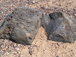
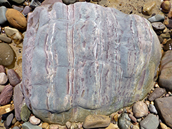
Although some older rock units such as the Sturt Tillite (Fig. 6) and Angepena Formation (Fig. 7) are represented amongst the erratics in the late Paleozoic glacial sediments, the oldest rock unit found in situ in the map area is the Wilmington Formation.
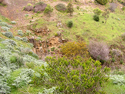
The Wilmington Formation is exposed, albeit intermittently, along Waterfall Creek near the waterfall between the lake and the Adelaide to Seaford railway line (Figs 8, 9). It comprises green-grey siltstone and fine-grained sandstone, partly with ripple marks and small-scale cross-bedding. The Marino Arkose Member, a coarse-grained, calcareous-cemented feldspathic grit with large rounded red feldspar grains up to 5 mm across, occurs at the base, and is exposed in the south bank of Waterfall Creek just east of the railway line. It is overlain by ripple-marked siltstone with thin interbeds of limestone and sandy limestone, which are also regarded as tongues of the interfingering Marino Arkose Member.
Figure 6 Erratics of Sturt Tillite, eroded out of late Paleozoic tillite of the Cape Jervis Formation, north end of Hallett Cove beach. (Photo 417973)
Figure 7 Erratic of early Marinoan Angepena Formation siltstone with mud-cracked and disrupted red shale bands, eroded out of late Paleozoic tillite of the Cape Jervis Formation, Hallett Cove beach. (Photo 417974)
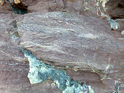
The Wilmington Formation is overlain by the Elatina Formation. At the base is a reddish brown, fine- to medium-grained sandstone containing trains of red lithic granules. This is overlain by the Reynella Siltstone Member, a dark red, poorly bedded siltstone containing scattered red granules and rare small pebbles, and well-bedded siltstone intercalations, some of which show rhythmic laminations. There is limited exposure of these beds in Waterfall Creek (Fig. 10), but much better outcrops are found in the coastal cliffs north of the map area.
The Elatina Formation and its Reynella Siltstone Member, though only very sparsely pebbly, represent the Elatina glaciation (Williams et al. 2011) in the Adelaide region.
Figure 8 Steeply west-dipping lower Wilmington Formation siltstone with limestone and interbeds, Waterfall Creek. (Photo 417975)
Figure 9 Upper Wilmington Formation siltstone grading up into flaggy and finally massive, fine-grained, greenish grey sandstone, Waterfall Creek. (Photo 417976)
Figure 10 Dark red, cleaved Reynella Siltstone Member overlying poorly exposed sandstone of the Elatina Formation, Waterfall Creek, east of lake. (Photo 417977)
Wilpena Group
The Reynella Siltstone Member is overlain with a sharp, erosive contact by massive, reddish grey and brown sandstone and quartzite of the Seacliff Sandstone. This boundary is correlated with the base of the Wilpena Group in the Flinders Ranges (Thomson 1966; Dyson 1992). The sand was rapidly deposited under post-glacial transgressive conditions, and contains dewatering structures. Local thin red siltstone and shale interbeds are lenticular and intermittent.
Thinly bedded, pink to buff-coloured, fine-grained dolomite of the Nuccaleena Formation, commonly 1–10 m thick, occurs at the base of the Wilpena Group in the Flinders Ranges. At Hallett Cove, however, the dolomite occurs as lenses interfingering with the Seacliff Sandstone. The thickest of these dolomite units conformably overlies the Seacliff Sandstone at the north end of Black Cliff, where it grades up into thinly bedded, dark red siltstone of the Brachina Formation (Fig. 11).
The Brachina Formation was deposited as silt on the outer continental shelf at a time of highest sea level after post-glacial transgression. Interbedded, fine-grained sandstone beds up to 15 cm thick displaying flute casts on the soles of beds are interpreted as storm-modified turbidites (Fig. 12).
From these deepest water conditions, the basin gradually shallowed, culminating in the deltaic ABC Range Quartzite that crops out at O’Sullivan Beach, south of Hallett Cove (Fig. 1). These are the youngest Ediacaran rocks exposed near Hallett Cove, but red mudstone of the Bunyeroo Formation overlies the ABC Range Quartzite near Ochre Point. There are erratics of the quartzite in the late Paleozoic Cape Jervis Formation. The Wonoka Formation, Bonney Sandstone and Rawnsley Quartzite of the uppermost Wilpena Group in the Flinders Ranges are not represented near Adelaide.
After a major hiatus in deposition, represented by a major unconformity, sedimentation resumed in the Early Cambrian and continued until the start of Middle Cambrian time (c. 510 Ma), but these sediments have all been eroded from the Hallett Cove area.
Figure 11 Fine-grained sandstone interbeds in lower Brachina Formation, north of Black Cliff. (Photo 417978)
Figure 12 Flute casts (arrowed) on sole of storm-modified turbidite sandstone bed in lower Brachina Formation, north of Black Cliff. Staff 1.0 m long. (Photo 417979)
Late Paleozoic: Carboniferous–Permian
In the latest Carboniferous to Early Permian, the supercontinent Gondwana lay in the south polar region; South Australia was covered by a continental ice sheet – the state’s third major glaciation. The unconformity between the Neoproterozoic rocks and the base of the Carboniferous–Permian glacial sediments represents a time gap of approximately 300 million years.
Cape Jervis Formation
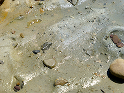
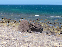
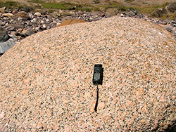
Glacial sediments of the Cape Jervis Formation are preserved within a steep-sided, north-northwest-trending glacially eroded valley cut into the bedrock. The deepest part of the valley is filled with massive diamictite interpreted by Bourman and Alley (1990) as lodgement tillite (Fig. 13). It is exposed on Hallett Cove Beach where beach sand cover is very thin to absent, but its thickness is unknown. It has a matrix of greenish grey, sandy mudstone and a wide variety of pebbles and cobbles derived from bedrock outcrops both locally and further south. Two large erratics of fine-grained, cross-bedded sandstone (probably Wilmington Formation) have been eroded out of the tillite (Fig. 14). Other erratics include granite from Encounter Bay (Fig. 15).
Figure 13 Cape Jervis Formation diamictite with sandy mudstone matrix on shore platform is interpreted as lodgement tillite. (Photo 417980)
Figure 14 Two large erratics of fine-grained, cross-bedded sandstone (probably Wilmington Formation) eroded out of Cape Jervis Formation tillite, Hallett Cove beach. (Photo 417981)
Figure 15 Erratic of Encounter Bay Granite eroded out of Cape Jervis Formation tillite, Hallett Cove beach. (Photo 417982)
The upper part of the glacial valley broadens out but did not extend beyond the artificial lake on Waterfall Creek and the Adelaide to Seaford railway line, where bedrock is exposed. This wider valley is floored by a polished and striated bedrock surface extending north along the clifftop from Black Cliff. The orientation of striae, asymmetric features such as crescentic gouges, and the inferred sources of glacial erratics, all confirm the general direction and sense of ice movement toward the north-northwest. The valley is filled with glaciolacustrine, thinly bedded, locally varved, weakly lithified, grey-green shale overlying the basal lodgement till. Bourman and Alley (1990) envisaged deposition in a lake dammed by ice against a bedrock slope to the east. Abundant dropstones in these sediments indicate the presence of floating ice. Prominent erratics include boulders of ABC Range Quartzite, Seacliff Sandstone, calcareous Marino Arkose Member, Wilmington Formation sandstone and Sturt Tillite, as shown on the geological map.
Sandstone interbeds up to 15 cm thick are commonly graded, suggesting deposition by turbidity currents (Fig. 16). Locally the shales display slump folds (Fig. 17). A medium- to coarse-grained massive sandstone, possibly aeolian, is associated with lenses of diamictite interpreted as flow tills (Fig. 18) within the glaciolacustrine shales (Bourman and Alley 1990). Some large boulders have been eroded from the flow till, e.g. limestone from the Marino Arkose Member (Fig. 19).
Normington et al. (2018) summarised the glaciation and deposition of the Cape Jervis Formation in terms of five stages: (i) formation of glaciated surfaces, (ii) deposition of lodgement till from ice advancing from the south, (iii) stagnation and retreat of ice and formation of glacial lakes, (iv) formation of a flow-till complex by further down-wasting and southerly retreat of ice, and (v) sea-level rise and marine incursion recorded at Cape Jervis.
Figure 16 Glaciolacustrine shale with graded sandstone interbeds, Cape Jervis Formation. (Photo 417983)
Figure 17 Slump fold in glaciolacustrine shale, Cape Jervis Formation. Staff 1.0 m long. (Photo 417984)
Figure 18 Boulder-bearing flow till overlain by glaciolacustrine sandstone and shale, Cape Jervis Formation. This outcrop, the Sugarloaf, is capped by Pleistocene red-brown sandy clay. (Photo 417985)
Figure 19 1.2 m wide boulder of sandy limestone from Marino Arkose Member eroded out of interpreted Cape Jervis Formation flow till interbedded with glaciolacustrine shales. (Photo 417986)
Permian to Cenozoic
During the almost 300 million year time gap in the rock record at Hallett Cove after the late Paleozoic glaciation, major sedimentary successions of Permian to Cenozoic age were deposited in basins in the north of South Australia. The bedrock and Carboniferous–Permian sediments of the Mount Lofty Ranges underwent deep weathering. During the Late Jurassic rifting commenced along what is now Australia’s southern continental margin and at c. 96 Ma (Late Cretaceous), Australia separated from Antarctica. At c. 45 Ma (Middle Eocene), Australia began its more rapid northward motion. Eocene to Miocene sediments were deposited in the Adelaide – Golden Grove Embayment of the St Vincent Basin to the north and Noarlunga and Willunga embayments to the south. Hallett Cove, situated at the southwestern end of the Mount Osmond Fault Block that was uplifted during the Cenozoic along the Eden Burnside Fault (Preiss 2019b), occupied a peninsula between these embayments.
Pliocene
Hallett Cove Sandstone
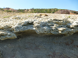
It is uncertain whether the Eocene to Miocene sediments of the Noarlunga Embayment originally extended as far north as Hallett Cove. If they did, they were certainly removed by erosion by the time the sea transgressed onto the eroded fault block in the Pliocene, when the shelly, calcareous Hallett Cove Sandstone was deposited in the littoral zone. The sandstone contains fossils including bivalves such as oysters, and the large, multi-chambered foraminifer Marginopora. Many of the shells are preserved only as external moulds. The sandstone rests unconformably on the eroded surface of the Cape Jervis Formation (Figs 20, 21), but probably did not extend past the eastward limit of these easily eroded and partly exhumed glaciolacustrine sediments. The sandstone is not seen in contact with the bedrock high to the east.
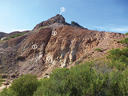
Figure 20 A thin layer of calcareous Hallett Cove Sandstone (1) forming a ledge above the eroded surface of weathered Cape Jervis Formation shale (2) is overlain by red-brown Pleistocene sediments (3). (Photo 417987)
Figure 21 Calcareous Hallett Cove Sandstone with external moulds of bivalve shells disconformably overlying the eroded surface of weathered Cape Jervis Formation shale. (Photo 417988)
Quaternary
The Quaternary Period is marked by repeated climatic cycles of glacial and interglacial episodes, but glaciation was restricted to relatively high latitudes. In South Australia, sediments are dominated by clayey, sandy and gravelly alluvial fan and floodplain deposits, slope deposits, and wind-blown sands and silts.
The Quaternary stratigraphy of Hallett Cove is well displayed in erosional features and comprises both Pleistocene and Holocene sediments. The earliest Quaternary is represented by lenticular beds of weakly iron-cemented pebble conglomerate of the Ochre Cove Formation. At Marino Rocks, these lenses have been observed overlying the Plio-Pleistocene Burnham Limestone, while on the clifftops at Hallett Cove, they overlie the Hallett Cove Sandstone or the Cape Jervis Formation where the Hallett Cove Sandstone is missing. The pebbles are typically hematite-stained siltstone or fine-grained sandstone derived from the Wilmington Formation. The base is not exposed, but is inferred to be erosional. Outcrops of Ochre Cove Formation lenses have been observed as far east as the lower parts of The Amphitheatre (Fig. 22), where they are overlain by red mottled sandy clay of the Hindmarsh Clay. Southeast of the Sugarloaf, sandy clay directly overlies the Cape Jervis Formation.
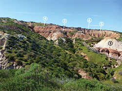
The Hindmarsh Clay contains a prominent, weakly indurated, white and red iron-mottled sandstone interbed forming an erosional ledge on the face of The Amphitheatre, and is overlain by the upper part of the Hindmarsh Clay (Fig. 23).
Figure 22 Iron-mottled gravel of Ochre Cove Formation (1) overlain by sandy clay in the lower part of the Hindmarsh Clay (2), followed by a ledge-forming, iron-mottled, weakly indurated sandstone member (3) in the middle part of the Hindmarsh Clay, east of the Sugarloaf. (Photo 417989)
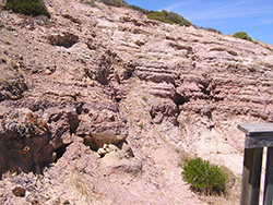
Figure 23 Pleistocene sediments in The Amphitheatre overlie white, weathered Cape Jervis Formation shale (1) and Pliocene Hallett Cove Sandstone: red-brown, sandy lower Hindmarsh Clay (2); ledge of more resistant iron-mottled sandstone (3); red-brown upper Hindmarsh Clay (4); purplish grey Keswick clay (5); pale brownish, aeolian, calcareous silt with calcrete cap (6). (Photo 417990)
A subtle but persistent colour change in the clays is suggested as the boundary between the Hindmarsh Clay and the overlying Keswick Clay (Firman 1969; Sheard and Bowman 1998; Sheard et al. 2016). However, confirmation that the uppermost clay unit correlates with the Keswick Clay will require mineralogical analysis.
Ward (1966) defined a weakly consolidated, orange-brown, medium-grained, well-rounded sand at the Hallett Cove Beach railway station as the Ngankipari Sand. The extent of this unit is uncertain; although Ward claimed an extent as distant as Lonsdale, sands at these locations are completely unconsolidated, unlike the type Ngankipari Sand which has been affected by calcrete formation in the form of nodules, crusts and rhizomorphs. The Ngankipari Sand is tentatively considered to be Late Pleistocene.
The Late Pleistocene Pooraka Formation, which forms prominent alluvial fans along the Eden–Burnside and Para fault scarps, is represented at Hallett Cove only by local channel fills of sandy and pebbly clay with rubbly, nodular calcrete paleosols in the north of the map area. In 1992 fossil remains of the world's largest marsupial, Diprotodon, were discovered in similar alluvial sediments of the Field River, located inland from the southern end of Hallett Cove beach. In the latter part of the Late Pleistocene humans arrived in Australia, about 65,000 years ago (Clarkson, Jacobs and Pardoe 2017), but the age of the Aboriginal implements found at Hallett Cove is uncertain.
Calcrete paleosols are widely developed in South Australia (Dart et al. 2007). At Hallett Cove, a prominent calcrete profile occurs above the Pleistocene succession exposed in The Amphitheatre. The calcrete includes nodules and laminar sheets developed at the top of off-white calcareous silt of presumed aeolian origin. During cold, arid climatic episodes when sea levels were much lower, the continental shelves, including Gulf St Vincent, were largely exposed. Wind erosion of the Cenozoic marine carbonates on the shelves produced lime dust which was spread over the landscape, and subsequently underwent soil processes of dissolution and re-precipitation to form calcrete (Dart et al. 2007). The calcrete at Hallett Cove also caps sections of older units at lower elevations between The Amphitheatre and the coast, suggesting the formation of a seaward erosional slope after deposition of the Keswick Clay but before calcrete formation. East of the Carboniferous–Permian glacial valley, calcrete directly overlies bedrock.
Over large areas of the seaward-facing slope of Hallett Cove, the calcrete surface is covered with thin, patchy deposits of loose, well-sorted pale brown, fine-grained sand of wind-blown origin. Although there is no dating for this surficial sand, it is completely unconsolidated and not affected by calcrete formation; it may therefore be early Holocene. These surficial sands are incised by a number of gullies, the deepest of which contains Waterfall Creek. Holocene clayey, sandy and pebbly alluvium in these gullies is itself incised by currently active channels and their gravelly bedload. On steeper slopes, talus deposits of angular bedrock clasts are set in poorly sorted sandy and silty clay, some clast rich and some matrix dominated.
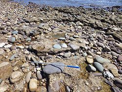
Figure 24 Beachrock formed by lime cementation of well-rounded gravel (a coarse facies of the Semaphore Sand Member) on the shore platform, overlying Cape Jervis Formation tillite. Staff 1.0 m long. (Photo 417991)
The present shoreline results from sea level rise after the last Pleistocene glaciation. In South Australia, shoreline deposits of this Holocene transgression are termed Saint Kilda Formation, represented at Hallett Cove by the Semaphore Sand Member. These well-sorted quartz sands patchily cover the shore platform of the actual cove, itself developed on softer tillite of the Cape Jervis Formation while the harder Neoproterozoic bedrock forms cliffs and shore platforms to the north and south. Pebbles, cobbles and small boulders derived from the cliffs cover the shore platform adjacent to the cliffs and are undergoing rounding by wave action. These gravels even extend beyond the cliffs some distance south of Black Cliff, and here a small patch has been cemented with lime to form beachrock, overlying the Cape Jervis Formation tillite (Fig. 24).
Most of the gentler slopes in the map area that are not undergoing active erosion have thin soil cover. These soils vary from pale brown sandy loam where developed on the surficial sands to clayey loams further inland, where they lie upon weathered bedrock or calcrete.
Structure and tectonics
Delamerian Orogeny
At the end of Early Cambrian sedimentation at c. 510 Ma, plate convergence well to the east of South Australia led to the Delamerian Orogeny, which deformed the Neoproterozoic and Cambrian rocks of the Mount Lofty and Flinders ranges.
The strongly folded, faulted and cleaved Neoproterozoic strata at Hallett Cove occupy the west limb of a large-scale regional, south-southwest-plunging anticline with superimposed smaller scale folds. Overall younging is toward the west, as confirmed by cross-bedding in sandy layers. Folds are generally asymmetric, with axial planes and axial plane cleavage dipping to the east.
Minor folds also plunge to the south-southwest, so that the stratigraphy exposed in the cliffs also youngs to the south. The thick-bedded sandstones and quartzites of the Seacliff Sandstone are highly competent, and have responded to the compressive stresses of the Delamerian Orogeny by forming open, concentric folds and minor brittle faults. In contrast, the thinly bedded siltstones of the Brachina Formation formed tighter, chevron-style folds, as seen at the foot of Black Cliff (Fig. 25).
Several faults are exposed in the map area. The most obvious can be seen from the wooden stairs north of Black Cliff (Figs 26, 27), where a band of pink dolomite with red shale interbeds is faulted against quartzite of the Seacliff Sandstone to the west. This steeply dipping fault is difficult to trace laterally, as it passes northward under shale of the Cape Jervis Formation, while to the south it is largely covered by cobbles on the shore platform; beyond this point the movement appears to have been taken up on bedding planes within the Seacliff Sandstone. Two more faults exposed within the Seacliff Sandstone at the mouth of Waterfall Creek (Fig. 28) are brittle structures, characterised by narrow brecciated zones and abrupt changes of bedding orientation.
Figure 25 Chevron-style folds in thinly bedded siltstone of the Brachina Formation at the foot of Black Cliff. (Photo 417992)
Figure 26 Wooden steps on cliff exposing west limb of anticline in Seacliff Sandstone north of Black Cliff. At the corner in the steps is a fault juxtaposing dolomite of the Nuccaleena Formation against thickly bedded quartzite of the Seacliff Sandstone. (Photo 417993)
Figure 27 Detail of the steeply dipping fault in figure 26 separating flaggy, pink dolomite of the Nuccaleena Formation dolomite from quartzite. (Photo 417994)
Belperio et al. (1990) used shallow marine seismic surveys to map the extension of the Eden–Burnside Fault offshore from Hallett Cove.
The presence of slickensided surfaces along some bedding planes in the Brachina Formation indicates bedding-plane slip during folding. There are also local discordances in bedding orientation exposed on the shore platform north of Black Cliff due to minor bedding-parallel faulting (Fig. 29). Other minor slip surfaces with thin quartz–chlorite veins along them cut across bedding (Fig. 30).
Figure 28 Steeply northwest-dipping brittle fault in Seacliff Sandstone at the mouth of Waterfall Creek. (Photo 417995)
Figure 29 Drag fold adjacent to bedding-plane slip in thinly bedded siltstone of the Brachina Formation on shore platform. (Photo 417996)
Figure 30 Thin quartz–chlorite vein along a minor slip surface in cross-bedded, fine-grained sandstone of the Brachina Formation. (Photo 417997)
In contrast to rocks in the eastern Mount Lofty Ranges, which were highly metamorphosed in the Delamerian Orogeny, the Neoproterozoic strata at Hallett Cove, though strongly lithified, have been metamorphosed only at very low grade, probably reaching a maximum temperature of only about 300° C. Slaty cleavage is developed in the fine-grained siltstones of the Wilmington Formation and Brachina Formation, while the sandstone and quartzite units display only a crude spaced cleavage or no tectonic fabric.
Post-Delamerian tectonics and geomorphology
After the Delamerian Orogeny, the Delamerian mountains were actively eroded and, by the time of the Carboniferous–Permian, the present crustal level was already exposed at the surface. The Carboniferous–Permian glaciation affected large areas of South Australia and left widespread glacial deposits, but these have been preserved only in favourable sites such as tectonically depressed basins (Alley et al. 1995). The deposits at Hallett Cove form part of the Troubridge Basin, but they occupy only a minute remnant of the former extent of this basin. Much more extensive occurrences of the glacial sediments are found on Fleurieu Peninsula and southern Yorke Peninsula, and they have been mapped using seismic data across Gulf St Vincent (Party and Weste 1998). The preservation of glacial sediments at Hallett Cove, which is on an uplifted fault block elsewhere devoid of sediments of this age, indicates that they must occupy a deeply scoured glacial valley. Preiss (2019b) argued that the more extensive glacial deposits of southern Fleurieu Peninsula have been preserved due to post-Permian extensional movement on the Willunga Fault, prior to more recent compressional uplift on this structure.
The St Vincent Basin evolved during the Cenozoic at the same time, and by the same process of east–west compression of the Australian continent, as the Mount Lofty Ranges were being uplifted; the Mount Osmond Fault Block upon which Hallett Cove is situated was tilted southward (Preiss 2019b). The sea transgressed into the Noarlunga Embayment to the south and the Adelaide – Golden Grove Embayment to the north during the Eocene. Despite the uplift of this fault block, there was a coastline near Hallett Cove in the Pliocene when the Hallett Cove Sandstone was deposited in a littoral environment that occupied the partially exhumed late Paleozoic glacial valley, but did not extend far upslope inland. Post-Pliocene uplift raised the fault block, including Hallett Cove, to its present elevation.
The present undulating landscape inland from Hallett Cove resulted from fluvial incision of the Mount Osmond Fault Block during the Quaternary. Material eroded from the valleys was deposited as alluvial fans of the Pooraka Formation north of the Eden–Burnside Fault scarp. During times of low sea level in the Pleistocene cold, arid episodes, wind-blown lime silt blanketed the landscape and was largely converted to calcrete by soil processes. During the milder conditions of the Holocene, further gullies were eroded, cutting into the calcrete and older deposits, while sea level rose dramatically, reaching a maximum at c. 6 thousand years before present (ka) (Lambeck and Nakada 1990). This caused erosion of the coastline to its present position, forming high cliffs in the hard Neoproterozoic bedrock and forming coves where Carboniferous–Permian glacial valleys were partially exhumed. Hallett Cove is but one of these – others are found further south on Fleurieu Peninsula. Erosion of the Pleistocene clays and overlying calcrete crust formed The Amphitheatre and its steep-sided gullies, and continues to the present day.
Geological history
The geological history of Hallett Cove began before the formation of its oldest exposed rocks. Initial rifting of the South Australian Precambrian Craton at c. 830 Ma led to the birth of the Adelaide Geosyncline, a complex of rift and sag basins in which a total thickness of 10–15 km of sedimentary and minor volcanic rocks, exposed throughout the Flinders and Mount Lofty ranges, accumulated over the next 320 million years.
The outcrops at Hallett Cove represent sedimentation only during the latter half of this period, commencing during the interglacial period between the two great Cryogenian glaciations of South Australia: the Sturt and Elatina glaciations. The preserved record of events is not continuous – there are major gaps between the mid-Ediacaran and the Early Cambrian, and from the Cambrian Delamerian Orogeny until the Late Carboniferous. Post-Permian sedimentation and tectonic events are recorded in other parts of South Australia, but can only be inferred at Hallett Cove, where the record resumes in the Pliocene, and continues, more or less punctuated, through the Quaternary Period. A summary of the key recorded events in earth history and the time periods they represent follows.
Neoproterozoic
c. 830–800 Ma
Initial rifting took place along northwest- to north-northwest-trending fractures; mafic dykes were intruded and lavas erupted; evaporitic mixed clastic–carbonate sediments of the Callanna Group were deposited in rift basins. The Adelaide region remained on the western rift shoulder during this initial stage and left no sedimentary record.
c. 800–700 Ma
North–south trending rift basins were formed; sand, silt and dolomite of the Burra Group of Torrensian age were deposited in fluvial, marginal marine and marine shelf settings; these are the oldest sediments in the Adelaide area.
c. 670–660 Ma
Sturt glaciation: glaciomarine diamictite (Sturt Tillite) and associated sand, silt and minor carbonates were deposited in a shelf setting.
c. 660–645 Ma
Post-glacial transgression led to deposition of late Sturtian carbonaceous and calcareous siltstone of the Tapley Hill Formation and the oolitic Brighton Limestone, followed by the early Marinoan Angepena Formation redbeds. These formations represent deposition under conditions of post-rift thermal subsidence.
c. 645–640 Ma
The beginning of events recorded by in situ rocks at Hallett Cove: an influx of coarse granitic detritus marks the onset of a transgressive–regressive sequence, the Wilmington Formation. Laminated grey-green shales above the uppermost arkose tongues of the basal Marino Arkose Member represent maximum flooding, while the overlying sediments coarsen upward to massive fine-grained sandstone, reflecting filling of the basin.
c. 640–635 Ma
The Elatina glaciation is well recorded in the Flinders Ranges. At Hallett Cove a thin, pale red-brown sandstone correlated with sandstone of the Elatina Formation contains lithic granule bands of possible fluvioglacial origin. This was followed by deposition of the dark red, massive to laminated Reynella Siltstone Member over an erosive surface. This unit contains tidal rhythmites, granules, irregularly dolomitised intervals and rare small glacial clasts, and broadly correlates with the glacial diamictites of the Elatina Formation in the Flinders Ranges.
c. 635–600 Ma
Post-glacial sea-level rise initiated the next transgressive–regressive sequence, the Sandison Subgroup. The base of the Seacliff Sandstone is a major sequence boundary, and correlates with the base of the Wilpena Group in the Flinders Ranges where dolomite and shale of the Nuccaleena Formation transgressively overlie the Marinoan-aged glacials. At Hallett Cove massive sands were deposited by grain flow in deepening water. During intervals of reduced sediment supply, lenticular silt and dolomite beds were deposited, the latter equivalent to the much more continuous Nuccaleena Formation. Maximum flooding is probably represented by the very fine grained, dark red siltstones at the gradational base of the Brachina Formation. The remainder of the Brachina Formation represents highstand deposits: siltstone with fine-grained sandstone event beds reflect renewed sand supply at or below storm wave base, passing up to shallow-water, cross-bedded, red sandstone seen south of Hallett Cove. The upward-shallowing succession is capped with clean, cross-bedded quartzite of the ABC Range Quartzite of deltaic origin. This is the origin of some quartzite erratics at Hallett Cove.
Cambrian
c. 530–510 Ma
Deposition of the carbonate-dominated Normanville Group and turbidite-dominated Kanmantoo Group on Fleurieu Peninsula. These deposits have been eroded from the Hallett Cove area.
c. 510–490 Ma
Northwest-directed thrusting and associated folding of the Delamerian Orogeny affected the Mount Lofty Ranges, Fleurieu Peninsula and Kangaroo Island, followed by sinistral transpression, folding and metamorphism in the eastern Mount Lofty Ranges where early- and late-syntectonic granite plutons and mafic dykes were intruded.
Ordovician to Late Carboniferous
c. 490–480 Ma
Intrusion of post-tectonic granites and extrusion or shallow intrusion of felsic porphyry (Mount Monster in the South-East). These, as well as the syntectonic granites, appear as erratics in the Carboniferous–Permian glacial deposits at Hallett Cove.
c. 480–305 Ma
No events are recorded at Hallett Cove. The Delamerian mountains were progressively eroded.
Late Carboniferous to Early Permian
c. 305–280 Ma
The Australian portion of Gondwana underwent continental glaciation as it passed through the south polar region. Major steep-sided glacial valleys were glacially sculpted into the landscape, including on Fleurieu Peninsula and Hallett Cove. The deepest parts of the valleys were filled with lodgement till. Glacial lakes formed in the upper, wider part of the glacial valley where varved clays with sand interbeds were deposited. Abundant dropstones indicate the presence of floating ice. Glacial erratics were derived from nearby outcrops as well as much further afield, e.g. granite from Encounter Bay and porphyry from Mount Monster.
Mid-Permian to Paleocene
c. 280–45 Ma
No events are recorded at Hallett Cove, but important deposits formed in Permian, Triassic, Jurassic and Cretaceous basins of northern South Australia. In the Jurassic and Cretaceous, thick sedimentary successions were deposited on Australia’s southern margin during and after separation from Antarctica. Deep weathering occurred and paleoplains were formed in the area of the present Mount Lofty Ranges.
Eocene to Miocene
c. 45–5 Ma
The St Vincent Basin evolved with concomitant uplift of the Mount Lofty Ranges; Hallett Cove was situated on a peninsula projecting into the St Vincent Basin, formed by upthrusting and southward tilting of the Mount Osmond Block, with the Adelaide – Golden Grove Embayment to the north and the Noarlunga Embayment to the south.
Pliocene
c. 5–2 Ma
With a rise in sea level in the Pliocene, the shoreline lay just east of Hallett Cove where the calcareous and fossiliferous Hallett Cove Sandstone was deposited in a littoral environment.
Pleistocene
c. 2 Ma – 130 ka
Continuing uplift on the Mount Osmond Block raised Hallett Cove above sea level; early to mid-Pleistocene gravels and sands of the Ochre Cove Formation, derived from the rising Mount Lofty Ranges, were deposited in fluvial channels. These were followed by floodplain and lacustrine clays and sands of the Hindmarsh Clay and the expansive Keswick Clay on the western slopes of the Mount Osmond Block.
c. 130–80 ka
The Late Pleistocene Pooraka Formation formed alluvial fans along the Eden–Burnside Fault Scarp and filled local erosional valleys within the uplifted Mount Osmond Block.
c. 80–30 ka
Humans arrived in Australia during this period.
c. 30–11 ka
During the last glacial phase, sea levels were very low. Cold, arid conditions prevailed and lime dust was swept from the exposed floor of Gulf St Vincent, blanketing the eroded landscape. Soil processes of dissolution and re-precipitation of lime formed a hard surficial calcrete crust.
Holocene
c. 11–0 ka
With deglaciation, sea level rose, flooding Gulf St Vincent, and wave action cut the sea cliffs and shore platforms we see today. Streams such as Waterfall Creek cut channels into the landscape, aeolian sand was blown over the calcrete surface, and talus covered eroding slopes. Finally, sandy and clayey loam soils formed on the gently undulating upper parts of the landscape.
The future
The long-term future of the remarkable geological features preserved at Hallett Cove is not secure. Erosive forces of nature have exposed the rocks and the record they contain. Even without further human interference, these same forces will continue their attack. The glaciated pavement exposed only along a narrow clifftop probably extends some distance beneath the cover of soft, easily eroded glaciolacustrine shales and sandstones, but is limited to the east by the eastern side of the glacial valley. At the same time, the cliffs are facing constant attack from storm waves, abetted by instabilities in the rock caused by bedding planes, cleavages, faults and fractures. The landform features known as The Amphitheatre and the Sugarloaf also owe their origin to erosion. The relatively hard calcrete capping protects the underlying soft Pleistocene clays and sands of The Amphitheatre, but continued erosion of the clays by gullying tends to undercut the capping, and eventually it will all give way. In a few thousand years, all the soft late Paleozoic and Quaternary sediments will likely be gone, leaving a cliffline cut well back into the highly indurated Neoproterozoic rocks. Renewed uplift on the Eden–Burnside Fault can only accelerate these entirely natural processes. Global warming will raise sea levels, further exacerbating the attack on the coastal cliffs.
We are fortunate to be living in this narrow time window, with enough erosion having occurred to expose the wonders of Hallett Cove, but not yet sufficient to wipe these fragile relicts from the face of the map.
Acknowledgements
The many and varied contributions of all previous investigators of Hallett Cove geology are gratefully acknowledged, as they form the foundation upon which the present interpretations are based. I thank Carmen Krapf and Stacey Curtis for their helpful comments on the geological map, and Neville Alley and Elinor Alexander for their thoughtful reviews of the manuscript.
References
Alley N and Frakes LA 2003. First known Cretaceous glaciation: Livingston Tillite Member of the Cadna‐owie Formation, South Australia. Australian Journal of Earth Sciences 50(2):139–144.
Clarkson C, Jacobs Z and Pardoe C 2017. Human occupation of northern Australia by 65,000 years ago. Nature 547:306–310.
Cooper HM, Kenny M and Scrymgour JM 1972. Hallett Cove, A field guide. 2nd edn. South Australian Museum, Adelaide.
Dart RC, Barovich KM, Chittleborough DJ and Hill SM 2007. Calcium in regolith carbonates of central and southern Australia: its source and implications for the global carbon cycle. Palaeogeography, Palaeoclimatology, Palaeoecology 249:322–334.
Dyson IA and von der Borch CC 1986. A field guide to the geology of the late Precambrian Wilpena Group, Hallett Cove, South Australia. In AJ Parker ed., Eighth Australian Geological Convention, one day geological excursions of the Adelaide region: Geological Society of Australia. Geological Society of Australia, pp. 17–40.
Firman JB 1969. Stratigraphy and landscape relations of soil materials near Adelaide, South Australia. Transactions of the Royal Society of South Australia 93:39–54.
Giesecke R, Whatmough R and Major R 1999. A field guide to the geology of Hallett Cove and other localities with glacial geology on Fleurieu Peninsula. Field Geology Club of South Australia Inc., Adelaide.
Howchin W 1895. New facts bearing on the glacial features of Hallett's Cove. Transactions of the Royal Society of South Australia 19:61–69.
Howchin W 1924. Further discoveries of Permo-Carboniferous glacial features near Hallett Cove. Transactions of the Royal Society of South Australia 48:297–302.
Howchin W 1928. A geological sketch-section of the sea cliffs on the eastern side of Gulf St. Vincent, from Brighton to Sellick's Hill, with descriptions. Transactions of the Royal Society of South Australia 47:279–315.
Knoll AH, Walter MR, Narbonne GM and Christie-Blick N 2006. The Ediacaran Period: a new addition to the geological time scale. Lethaia 39:13–30.
Lambeck K and Nakada M 1990. Late Pleistocene and Holocene sea-level change along the Australian coast. Palaeogeography, Palaeoclimatology, Palaeoecology 89(1-2):143–176.
Ludbrook NH 1963. Correlation of the Tertiary rocks of South Australia. Transactions of the Royal Society of South Australia 87:5–15.
Mawson D and Sprigg RC 1950. Subdivision of the Adelaide System. Australian Journal of Science 13:69–72.
National Parks and Wildlife Service 1986. Hallett Cove Conservation Park management plan. Department of Environment and Planning, Adelaide.
Preiss WV 2019b. The tectonic history of Adelaide’s scarp-forming faults. Australian Journal of Earth Sciences 66(3):305–365.
Preiss WV, Gostin VA, McKirdy DM, Ashley PM, Williams GE and Schmidt PW 2011. The glacial succession of Sturtian age in South Australia: the Yudnamutana Subgroup. In: E Arnaud, GP Halverson and G Shields-Zhou eds, The geological record of Neoproterozoic glaciations, Memoirs 36. Geological Society, London, pp. 701–712.
Segnit RW 1940. Geology of the Hallett Cove district with special reference to the distribution and age of the younger till. Transactions of the Royal Society of South Australia 64:3–45.
Sprigg RC 1942. The geology of the Eden-Moana Fault Block. Transactions of the Royal Society of South Australia 66(2):185–214.
Sprigg RC 1952. Sedimentation in the Adelaide Geosyncline and the formation of the continental terrace. In MF Glaessner and RC Sprigg eds, Sir Douglas Mawson Anniversary Volume. University of Adelaide, pp. 153–159.
Talbot JL and Nesbitt RW 1968. The Hallett Cove area. In JL Talbot and RW Nesbitt, Geological excursions in the Mount Lofty Ranges and the Fleurieu Peninsula. Angus and Robertson, Sydney, pp.18–26.
Tate R 1877. Exhibited a glaciated rock from Hallett Cove at ordinary meeting of the Philosophical Society of Adelaide. Transactions of the Royal Society of South Australia 1:1.
Toteff S 1983. Draft management plan: Hallett Cove Conservation Park. National Parks and Wildlife Service, South Australia, Adelaide.
Ward WT 1966. Geology, geomorphology, and soils of the southwestern part of County Adelaide, South Australia, Soil Publication 23. CSIRO, Melbourne.
Williams GE, Gostin VA, McKirdy DM, Preiss WV and Schmidt PW 2011. The Elatina glaciation (Late Cryogenian), South Australia. In E Arnaud, GP Halverson and G Shields-Zhou eds, The Geological Record of Neoproterozoic Glaciations, Memoirs 36. Geological Society, London, pp. 713–721.
Willoughby M 2010. Overview of Hallett Cove geological history. Mindat.org, viewed August 2019.


