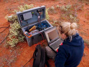
Electromagnetic (EM) geophysics helps unlock the mineral potential of South Australia by reducing the search space from the regional scale (several 100 kilometres) to the camp scale (a few kilometres).
EM methods, from long-period magnetotellurics (MT) to high-frequency airborne EM methods, are used in a variety of GSSA projects.
AusLAMP
The Australian Lithospheric Architecture Magnetotelluric Project (AusLAMP) is a collaborative, national project which set out to acquire long-period MT data to give 3D images of the electrical resistivity distribution of the crust and mantle, leading to a better understanding of prospectivity.

400 long-period MT sites comprised the South Australian part of the AusLAMP SA survey with the GSSA, the University of Adelaide, Geoscience Australia and National Collaborative Research Infrastructure Strategy (NCRIS) working together to develop the following outcomes:
- A connection between deep-crustal low resistivity zones beneath the eastern Gawler Craton Olympic Domain and the abundance of mineral occurrences in this iron oxide – copper–gold (IOCG) belt.
- A 3D MT model across the Ikara-Flinders Ranges and the Curnamona Province which has established compelling conductivity anomalies along the Nackara Arc and Curnamona Province, renewing interest in the Broken Hill Domain.
- Delineation of the western margin of the Gawler Craton and, in joint analysis with closer-spaced profile MT data, identification of large-scale lithospheric boundaries.
Gawler Phase 2 MT
The GSSA’s Gawler Phase 2 (GP2) project combines many geoscience techniques, including MT. An MT survey of the central-western Gawler Craton has been undertaken and data, modelling and analysis completed. All data is available via the SARIG catalogue.
Olympic Domain
The GSSA team worked with CSIRO to combine 333 broadband MT sites and 3261.6 line km of AEM data to develop a workflow for integration of MT and AEM data, along with the production of an improved map of depth to basement across the Olympic Domain.
Watch Dr Hoele Seille’s (CSIRO) presentation on Uncertainty mapping of the sedimentary basin architecture of the Olympic Domain: combining MT and AEM geophysics from Discovery Day 2021 for more about the Olympic Domain project.
Project data releases, reports and maps
Approximately 400 AusLAMP sites are available to download as EDI files from SARIG. The sites can also be viewed on SARIG as phase tensor ellipses or induction arrows.
3D models of the northeast of SA are available for download from SARIG, as are electrical resistivity depth slices for most of the state.


