
Updated 1:2 million scale geological map of South Australia out now.
The latest knowledge of the surface geology of the state is displayed on the 2020 edition of the state geology map newly released by the Geological Survey of South Australia (GSSA). It is a product of the GSSA’s ongoing statewide geological mapping program to undertake detailed studies in strategically important regions of South Australia.
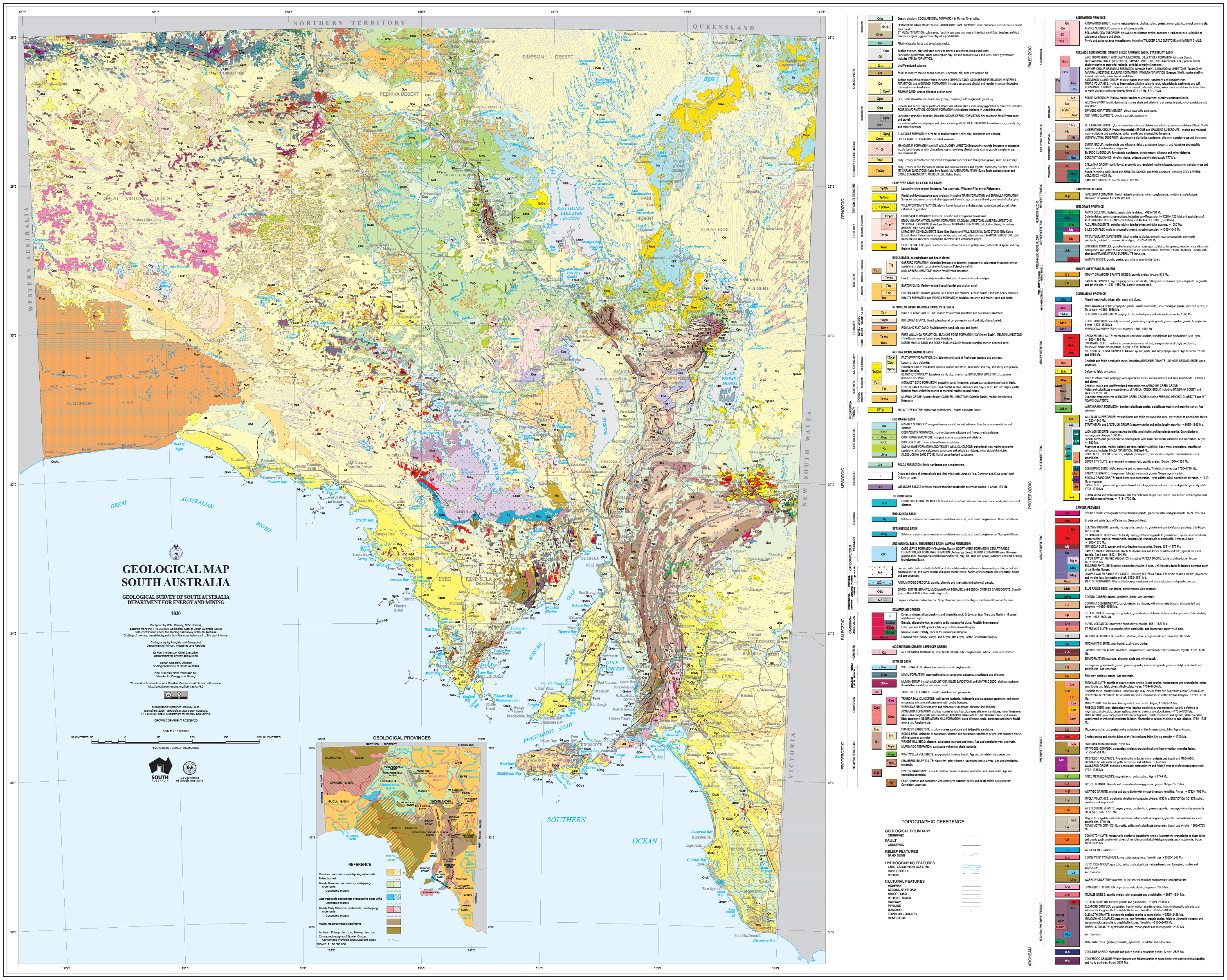
This map provides a consistent baseline dataset for broad regional surface geology presenting the entire state as a seamless geological coverage. The 1:2 million scale matches numerous statewide mapping products delivered by the GSSA including solid geology, regolith geology, special commodity and geophysical map releases. It delivers a broad-scale framework to assist with regional planning, geological interpretation and understanding the geological assets of South Australia.
Considerable progress in the understanding of the state’s geology has been facilitated by numerous mapping, geochronological and geochemical studies as well as geophysical surveys undertaken by the GSSA. Areas in which the geology has been significantly updated since the last edition include the southern Gawler Ranges margin, the northeastern part of the Eyre Peninsula, the eastern Musgrave Province, the Mount Painter area, the Curnamona Province and parts of the Yorke Peninsula.
The 2020 map replaces the 2001 edition and is the eighth version since first release in 1899. This substantially improved edition has been compiled by Wayne Cowley, former Principal Geologist in the GSSA, who continuously revised and updated the 1:2 million surface geology dataset. It includes significant contributions from many GSSA geologists and data scientists. Jonathan Irvine (GSSA) and Lee Tily (Primary Industries and Regions South Australia) were responsible for the cartography.
The map can be downloaded via the South Australian Resources Information Gateway (SARIG) as a PDF map product. The complementary digital map layer dataset can also be accessed, viewed and downloaded via SARIG (located in ‘All Map Layers’, 'Geology’, ‘Geology - surface geology’, ‘2M Geology’).
– Mario Werner, December 2020